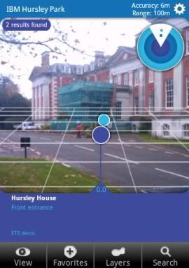
 One of the themes at openMIC this week was augmented reality, and a topic that came up a couple of times was Layar.
Layar is a mobile app for Android and iPhone that lets you display location-based information overlaid on a real-time camera view.
For example, the screen normally shows a viewfinder-like view from your mobile’s camera.
Search for “coffee” and a bunch of markers appear on the view, showing you where the nearest coffee shops are.
As you move the phone around, the markers follow the approximate location of the places they are showing you.
That’s assuming you want to search ‘Google Local’, but that’s not the only option. Location data is provided through “layars”, and there are layars available for location-tagged Wikipedia articles, Flickr photos, brightkite users, and more.
The interesting thing talked about at openMIC was the Layar API which lets anyone create a new Layar with their own information.
So I decided to spend a quiet Friday afternoon in the office creating a Layar for around Hursley. 🙂
This means a phone with the Layar browser installed can browse and search for points of interest around the site.
It was really very easy, so I’ll quickly outline the steps involved.

