Posts Tagged ‘openstreetmap’

Getting free routing data for the UK

Saturday, May 8th, 2010

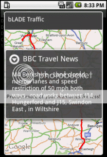
I wrote this week about my new Android app, which checks for road traffic problems affecting UK routes. I mentioned that it wasn’t ready for release yet, because there are a few admin issues that I need to sort.

One of the problems is in how I get the routing data.

The app relies on comparing the locations of traffic problems with the user’s route.

Getting the location of traffic problems isn’t too hard as there are feeds from the Highways Agency and the BBC that offer that.

But getting a detailed description of a route between two places, in a format that I can use to compare against the traffic problems, proved harder.

(more…)

minibar meets geomob

Saturday, March 28th, 2009

I went to Corbet Place in London yesterday night for Minibar.

MiniBar is a social evening in Shoreditch, which offers people a chance to snaffle some free beer while discussing p2p, web applications, start ups, social networking and general Web 2.0 mayhem & fandango.

photo 016I’ve heard of Minibar before, particularly from Andy and Roo, but never actually got around to going to one. In fact, the main reason that I went to this one is because it was being done as a joint event between minibar and geomob (a geo/mobile developers meetup group which I have been to before).

Despite being a newbie, I had a few ideas of what to expect. Andy described the place as a “dimly lit … brewery bar“, which pretty much sums it up. And more usefully, warned me to turn right when I arrived, to stand a decent chance of hearing the presentations – definitely a useful tip. 🙂

(more…)

OpenCellId – collecting data for mobile location-based services

Monday, August 18th, 2008

It is great to see a revived buzz around mobile location based apps and services. There are lots of new services to try. I try loads of them, the most recent was Moot just a few days ago (I love their video which I’ve embedded here – very cute), but there are way more than I can keep up with.

One problem they all share before they get to offer you their variations on useful location-based services is how to figure out where you are in the first place.

GPS is an obvious response, but not everyone has it on their mobile, and even if you do, it has some big problems – it can take a while to get a fix, won’t work indoors, etc.

Good solutions supplement this with other sources of information. Skyhook is getting a lot of attention at the moment for their service – mainly due to it being used in the iPhone. It means that the iPhone (and other devices using Skyhook) can work out where it is using GPS, but if a GPS fix cannot be made (or in the interim time while waiting for one) it can give an approximate location almost instantly using cell-tower triangulation and/or known WiFi access points.

(more…)